The first indication is often not a siren, a flare or a phone call. It is a faint signal in streams of satellite data, detected hundreds of kilometers above Earth and processed by algorithms trained to distinguish methane escaping from industrial facilities from clouds, dust and other atmospheric interference. Within days, analysts verify the finding, identify the likely source and notify operators or governments that a significant leak may be occurring.
That sequence—once impossible at global scale—is becoming an increasingly important part of efforts to reduce emissions of methane, a greenhouse gas that traps far more heat than carbon dioxide over the first two decades after it enters the atmosphere. As satellite technology, artificial intelligence and international cooperation converge, researchers and companies are turning orbital observations into practical tools that help identify leaks, prompt repairs and measure results.
The technology's importance lies not only in what satellites can see, but in what they enable people on the ground to do.
According to the United Nations Environment Programme (UNEP), its International Methane Emissions Observatory operates the Methane Alert and Response System (MARS), which combines observations from more than 30 satellite instruments with artificial intelligence to identify major methane emissions. Since becoming fully operational in 2024, the system has contributed to more than 40 methane mitigation actions worldwide after analysts reviewed detections and notified governments and companies. UNEP says more than 1.3 million satellite observations have been analyzed since 2023.
UNEP emphasizes that automation does not replace scientific judgment. Every AI-generated alert is reviewed by specialists before notifications are issued, reflecting the caution required when satellite imagery may influence operational decisions and regulatory responses.
The growing ability to detect leaks from space marks a significant shift from earlier approaches that relied largely on ground inspections, aircraft surveys and operator reporting. Those methods remain essential for confirming emissions and repairing equipment, but satellites now provide a broader view, helping identify facilities that warrant closer inspection.
Industry, governments and researchers are increasingly drawing on multiple satellite systems rather than depending on a single mission.
Although the Environmental Defense Fund's MethaneSAT spacecraft was lost in 2025 after approximately a year in orbit, researchers continue to analyze the data it collected, while other satellite constellations have expanded monitoring capabilities. The International Energy Agency (IEA) said MethaneSAT observations provided emissions estimates across dozens of oil and gas basins in multiple countries, while Canada's GHGSat constellation has attributed millions of tonnes of methane emissions to thousands of industrial sites worldwide.
Those observations are changing how emissions are measured.
Historically, methane inventories often relied on engineering estimates or periodic measurements. Satellite observations increasingly provide independent evidence of emissions from individual facilities, allowing regulators, investors and operators to compare reported emissions with atmospheric measurements. Researchers say that improved transparency can help identify persistent "super-emitter" events that contribute disproportionately to total emissions.
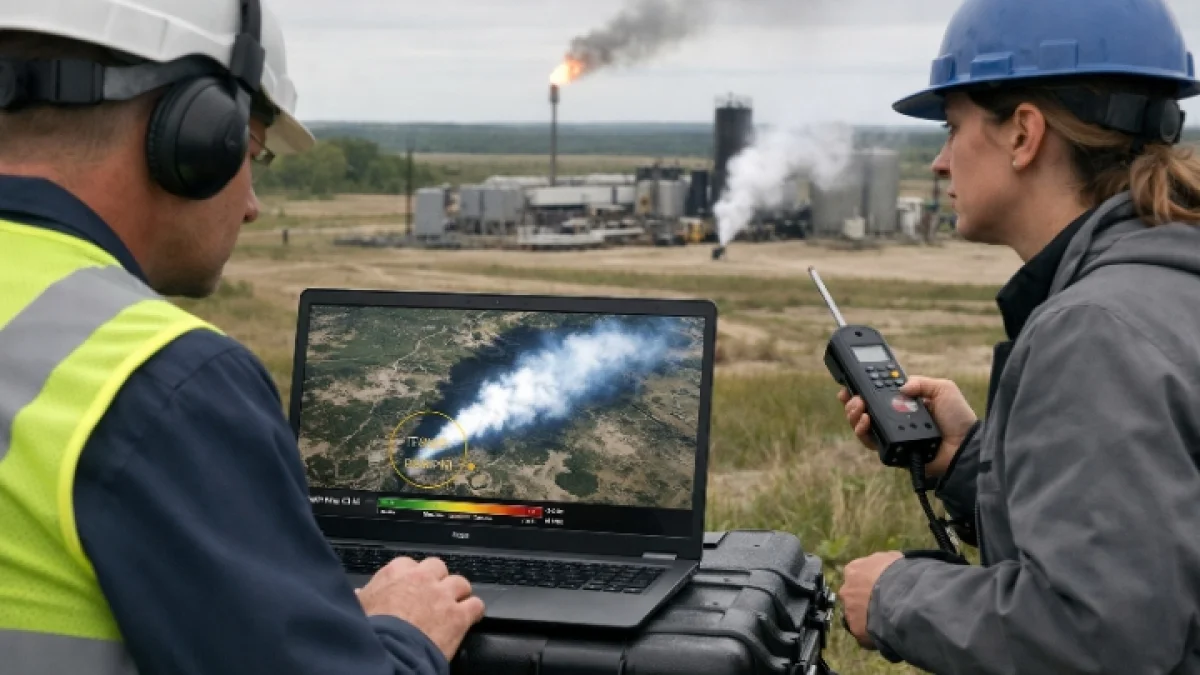
For engineers responsible for pipelines, compressor stations and production facilities, satellite alerts are only the beginning of the process. Ground crews must still travel to sites, inspect valves, storage tanks, compressors or pipelines, identify the cause of the release and verify that repairs have stopped the emissions. Satellite imagery cannot tighten a faulty connection or replace damaged equipment, but it can shorten the time between a leak occurring and someone knowing where to look.
Researchers continue to improve those detection systems.
Scientific teams are developing machine-learning models capable of identifying methane plumes more accurately from hyperspectral imagery while reducing false detections. Other studies are exploring faster onboard processing so future satellites can identify potential methane releases before transmitting vast quantities of raw data back to Earth, improving response times while reducing computing demands.
Governments are also integrating satellite monitoring into broader climate and environmental policies.
In Japan, Mitsubishi Electric and its partners are testing a system that combines wide-area satellite observations with higher-resolution imaging to identify suspected methane leaks for follow-up investigation. The project is intended to support emissions transparency and complement international reporting initiatives, illustrating how commercial satellite operators and public agencies are increasingly working together.
Despite rapid progress, experts caution that satellites are not a complete solution.
Cloud cover, atmospheric conditions and revisit times can limit observations. Different satellites vary in spatial resolution, sensitivity and coverage, making it necessary to combine multiple sources of information. Reviews of methane monitoring technologies conclude that satellites are most effective when integrated with aircraft, drones and on-site measurements that confirm emissions and verify repairs.
The broader significance extends beyond technology itself.
Methane remains one of the fastest opportunities to slow near-term warming because many industrial leaks can be repaired using existing equipment. Detecting those leaks more quickly can reduce product losses for operators while limiting greenhouse gas emissions. The IEA and UNEP both argue that increasingly detailed satellite observations are helping shift attention from estimating emissions toward taking action to reduce them.
As additional satellites enter orbit and analytical tools become more sophisticated, the challenge is evolving. The question is no longer simply whether methane can be detected from space, but how rapidly verified information can move from an orbital observation to a technician standing beside a repaired valve, compressor or pipeline. For scientists processing satellite imagery, engineers responding to alerts and communities living near energy infrastructure, that chain of events increasingly defines how innovation is translated into measurable environmental results.